
Thorong La pass to Jomson
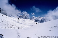
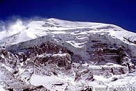
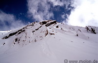
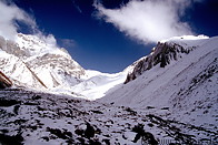
Climbing down was somehow sad, as the goal had already been reached. We couldn’t see the trail because of the snow but were able anyway to find our way to Muktinath, 1600 m lower. The mountains are spectacular and very close, so you can nearly touch with hands the glaciers you normally just see in pictures.
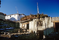
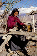
Muktinath is an ancient temple complex which has attracted both Hindu and Buddhist pilgrims for centuries. Apparently there is an helipad to make it easier for the Nepali royal family to visit it. The lodges are not here, but a little further down, in Ranipauwa. We arrived there in the late afternoon, very tired, with aching knees and feet. Everyone enjoyed the hot showers and the good meals, as the standard of these lodges is higher than that on the Manang trek.
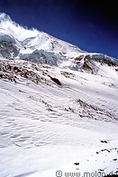
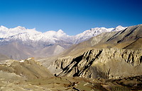
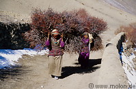
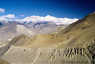
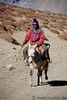
I left Ranipauwa in the early morning and the sunrise showed me an incredible landscape: barren land of different brown tones, under the white glaciers and the deep blue sky. I felt like being on the moon, if it hadn’t been for the few locals I met on my way and the beautiful towns like Jharkot (3550 m) that I found on my way. In the early morning I was nearly alone and I enjoyed the peaceful atmosphere. Closing up to Kagbeni I met quite a lot of trekkers coming up from the other side. In fact, many of those, who don't have that much time to spend on a trek make just one way trip up or down the Kali Gandaki valley and fly in or out from Jomson.
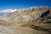
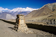
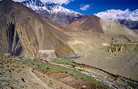
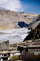
Since crossing the pass I was in the Mustang district, and to be more precise in South Mustang, as the entrance to north Mustang, which was not permitted until few years ago, requires a special permit, which is not only very expensive but also quite difficult to obtain. When you reach Kagbeni (2800 m) you have come as close to North Mustang as you can without the permit. Kagbeni is a very nice medieval town made up by crumbling mud-brick houses and stands in the middle of a green oasis of irrigated fields. Green is an actually very rarely seen colour in this region.
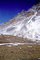
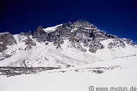
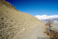
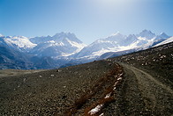
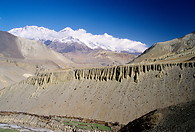
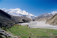
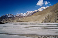
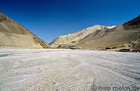
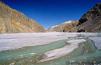
The trail continues towards Jomson, and leads you right into the middle of the riverbed, as the Kali Gandaki is reduced to several small and separate streams. The riverbed measures from 500m to a km. It is quite a hard walking because the trail is quite uneven when it takes you into the gravel riverbed (which means most of the time). Sometimes side valleys open up and you can catch a glimpse of the mighty Annapurna glaciers.
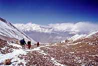
Two hours after having left Kagbeni I reached Jomson, where most of my new friends concluded the trek. I had my lunch in a bit poor lodge with view on the airport and walked on by my own again.
Muktinath is an ancient temple complex which has attracted both Hindu and Buddhist pilgrims for centuries. Apparently there is an helipad to make it easier for the Nepali royal family to visit it. The lodges are not here, but a little further down, in Ranipauwa. We arrived there in the late afternoon, very tired, with aching knees and feet. Everyone enjoyed the hot showers and the good meals, as the standard of these lodges is higher than that on the Manang trek.
I left Ranipauwa in the early morning and the sunrise showed me an incredible landscape: barren land of different brown tones, under the white glaciers and the deep blue sky. I felt like being on the moon, if it hadn’t been for the few locals I met on my way and the beautiful towns like Jharkot (3550 m) that I found on my way. In the early morning I was nearly alone and I enjoyed the peaceful atmosphere. Closing up to Kagbeni I met quite a lot of trekkers coming up from the other side. In fact, many of those, who don't have that much time to spend on a trek make just one way trip up or down the Kali Gandaki valley and fly in or out from Jomson.
Since crossing the pass I was in the Mustang district, and to be more precise in South Mustang, as the entrance to north Mustang, which was not permitted until few years ago, requires a special permit, which is not only very expensive but also quite difficult to obtain. When you reach Kagbeni (2800 m) you have come as close to North Mustang as you can without the permit. Kagbeni is a very nice medieval town made up by crumbling mud-brick houses and stands in the middle of a green oasis of irrigated fields. Green is an actually very rarely seen colour in this region.
The trail continues towards Jomson, and leads you right into the middle of the riverbed, as the Kali Gandaki is reduced to several small and separate streams. The riverbed measures from 500m to a km. It is quite a hard walking because the trail is quite uneven when it takes you into the gravel riverbed (which means most of the time). Sometimes side valleys open up and you can catch a glimpse of the mighty Annapurna glaciers.
Two hours after having left Kagbeni I reached Jomson, where most of my new friends concluded the trek. I had my lunch in a bit poor lodge with view on the airport and walked on by my own again.
|
|
|
|

|

|
|
|
|
|
|
|
|
|
|
|
|
|
|
|
|
|
|
|
|
|

|
|
Page viewed 66732 times since 03.08.2006
©Copyright Alfred Molon