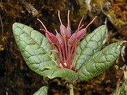
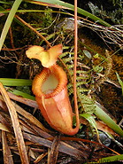
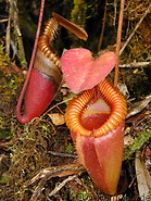
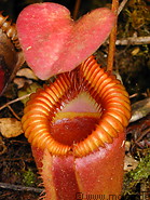
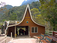
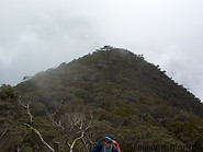
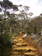
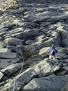
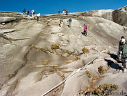
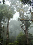
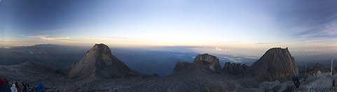
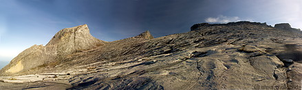
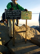
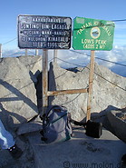
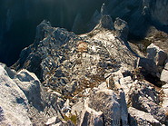
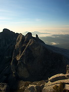
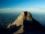
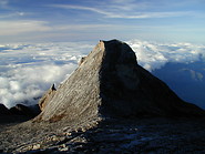
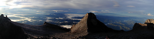
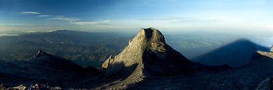
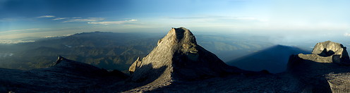
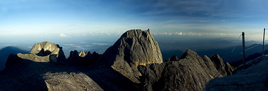
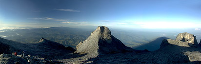
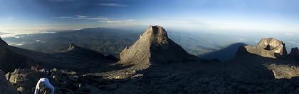
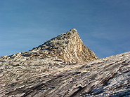
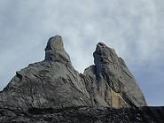
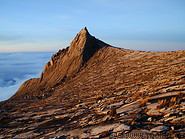
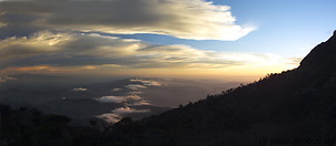
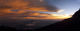
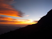
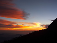
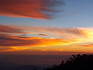
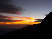
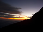
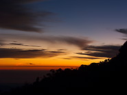
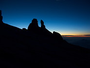
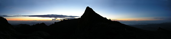
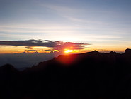
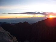
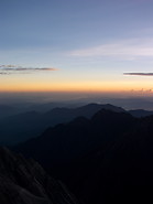
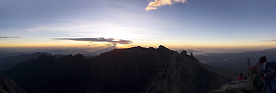
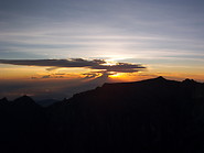
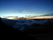
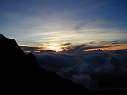
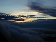
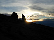
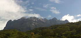
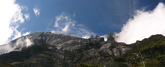
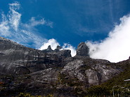
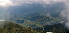
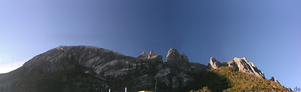
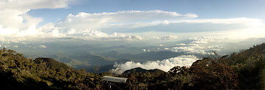
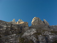
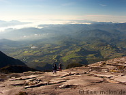
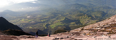
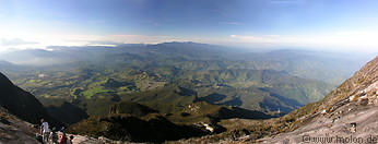
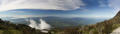
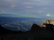
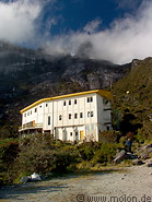
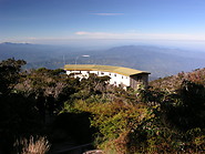
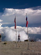
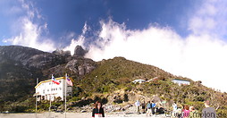
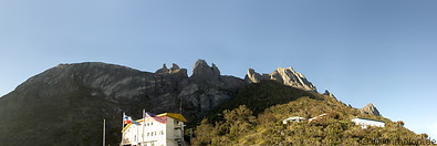
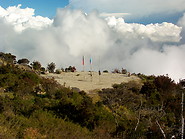
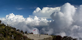
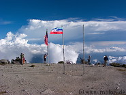
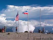
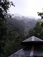
Mt Kinabalu, which lies in Sabah in northern Borneo, is at 4100 m the highest peak between the Himalayas and Papua New Guinea. Despite its height it is very easy to climb and does not require any special equipment or training. Anybody with sufficient stamina can climb the mountain - during my first climb in 2000 for instance I met a team of Japanese retirees on the peak. The climb begins at the Timpohon gate (1866 m altitude) and climbers usually make it to the Laban Rata resthouse at 3300 m on day one. Most of the climbers leave the next morning between 3am and 4am in order to reach the summit at 6am to experience the spectacular sunrise. It's important not to arrive to early on the summit, to avoid freezing in the cold night waiting for the sunrise. Adapting to the height is not really an issue, because Mt. Kinabalu is not that high (only 4100m - compare that to the Kilimanjaro, which is almost 6000m high) and because the whole climb lasts about 24 hours. Within 24 hours you go up and down.
00 Map 01 Timpohon gate 02 Summit trail 03 Waterfall 04 Summit trail
05 Trail through the mist 06 Summit trail 07 Summit trail 08 Summit trail 09 Summit trail 10 Antennas
11 Summit trail 12 Summit trail 13 Summit trail 14 View at 2700 meters 15 Summit trail 16 Km 8 at 5 37am
17 Last 500 meters 18 The way back 19 Climbers descending Mt Kinabalu 01 Kinabalu park headquarter 02 Nepentes Villa
03 Map of Kinabalu park and summit trail 04 Vegetation 05 Flower 06 Flower 07 Plant
08 Plant 09 Plant 10 Cricket 11 Plant 12 Plant
13 Vegetation 14 Vegetation 15 Fern 16 Plant 17 Ferns
18 Vegetation 19 Vegetation 20 Vegetation 21 Raspberry plant 22 Plant
23 Nepenthes (Pitcher plant) 24 Nepenthes (Pitcher plant) 25 Nepenthes (Pitcher plant) 26 Rhododendron 27 Rhododendron
28 Rhododendron 29 Vegetation 30 Vegetation 31 Signpost to Kinabalu NP 32 Fern
01 Mt Kinabalu at dawn 02 Panorama view at dawn
03 Mt Kinabalu massif 04 The Summit 05 The Summit 06 Gully
07 Peaks 08 St John peak 09 St John peak 10 St John peak
11 Panorama view with St John peak 12 Panorama view with St John peak
13 Panorama view with St John peak 14 View to the west
15 Panorama view with St John peak 16 Panorama view with St John peak
17 View with south peak 18 View of Low's peak 19 Donkey ears peak 20 South peak
01 Sunset panorama view 02 Sunset panorama view 03 Sunset
04 Sunset 05 Sunset 06 Sunset 07 Sunset
08 Sunset 01 Donkey ears peak at dawn 02 Dawn on Mt Kinabalu
03 Sunrise on Mt Kinabalu 04 Sunrise on Mt Kinabalu 05 Sunrise on Mt Kinabalu 06 Sunrise on Mt Kinabalu
07 Sunrise on Mt Kinabalu 08 Dawn on Mt Kinabalu 09 Dawn on Mt Kinabalu 10 Dawn on Mt Kinabalu
11 Sun between Donkey ears peak 01 View of Mount Kinabalu 02 Mt Kinabalu view from Laban Rata resthouse
03 Donkey ears peak 04 View over Sabah 05 Mt Kinabalu view from Laban Rata resthouse
06 View from Laban Rata resthouse 07 Donkey ears peak at sunset 08 View over Sabah
09 View over Sabah 10 View over Sabah
11 View from Laban Rata resthouse 12 View over Sabah 13 View over Sabah
01 Laban Rata resthouse 02 Laban Rata resthouse 03 Helipad and flags 04 View of Laban Rata resthouse and Mt Kinabalu
05 View of Laban Rata resthouse and Mt Kinabalu 06 Helipad 07 Helipad
08 Helipad and flags 09 Helipad and flags 10 Malaysia and Sabah flags 01 Lobster claw heliconia 02 Poring Hot Springs
03 View of the rainforest at sunset 04 View from canopy walk 05 Canopy walkway 06 View from canopy walkway 07 View from canopy walkway
08 Canopy walkway 09 View from canopy walkway 10 Sandakan market 11 Sandakan harbour 12 Fish for sale
13 Fish for sale 14 Sandakan fish market
Page viewed 1622 times since 12.05.24
©Copyright Alfred Molon