
Lofoten islands
 The Lofoten islands are an archipelago in northern Norway, located between 68°N and 69°N of latitude, 170 km north of the Arctic circle. Although these islands are located very far to the north, the winter temperatures are relatively mild. This is due to the Gulf Stream which brings warm water from the Gulf of Mexico to the northeast Atlantic.
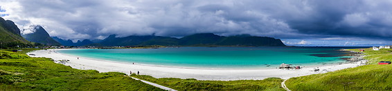
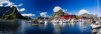
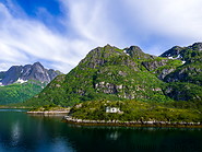
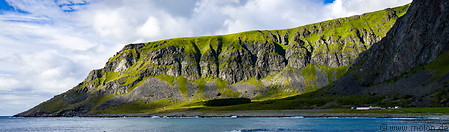
The islands are characterised by a rugged and steep coast, with steep rock walls raising from the sea, white sand beaches and picturesque fishermen villages. The Lofoten islands are a major tourist hotspot in the north of Norway.
The islands have been settled since prehistoric times (earliest human settlements date back to 11000 years). Over the past 1000 years the islands have been a centre for cod fishery. The oldest, still existing village is Kabelvaag, which was founded as Vågan in the early 12th century.
How to get to the Lofoten islands
There are four airports on the Lofoten islands (Røst, Værøy, Leknes or Svolvær). The islands can be reached by car or ferry.
Accommodation
There are several, mostly pricey, accomodation options, all bookable via the international booking portals.
|
|
|
49 photos of Flakstadøya, one of the smaller Lofoten island with the Nusfjord fishing village and the Ramberg beach
|
47 photos of Moskenesøya, the most touristy island of the Lofoten archipelago
|
|
|
|
|
|
16 photos of Austvågøya, the largest and northernmost of the Lofoten islands
|
29 photos of Vestvågøya, a large island in the centre of Lofoten archipelago
|
8 photos of the car ferry from Moskenes to Bodø
|
Gallery with all images
|
Page viewed 1060 times since 29.12.20
©Copyright Alfred Molon